Fur – How to visit the Danish fossil island
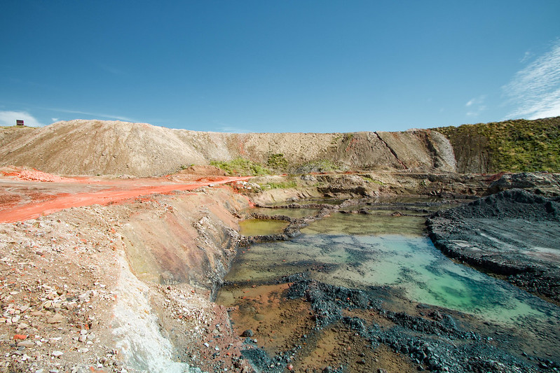
Heading to Fur Island in Denmark and wondering what to see and do? Here’s a guide to visiting the most colourful little island in Denmark.
Last week we went to Fur island; a place I’ve wanted to visit for a few months now. Fur is known as “Denmark’s most wonderful island” and it’s currently on the UNESCO tentative list.
I’ve been looking for the best nature in Denmark this summer, and when I heard that Fur island has landscapes unlike any other parts of the country, I wanted to spend some time there. So, my parents, younger brother, Theo and I decided to explore the island of Fur for one day.
Read next: Experience the 7 UNESCO sites in Denmark
This post contains referral links for products I love. Adventurous Miriam earns a small commission at no extra cost to you if you purchase through my links. I appreciate your support ♡ Learn more
Where is Fur Denmark?
The island of Fur is located in Limfjorden, a beautiful fjord running through North Jutland. The small island covers an area of just 22 km², which makes it’s a perfect place to bring your bike or hike if you’re up for it.
You can use this map of Fur (in Danish), which pinpoints several beautiful trails and highlights.
Fur Denmark has been inhabited since the Stone Age. The Vikings left traces there, and so did monks and nuns from the Middle ages. Not many people live here, just about 800 residents, many of whom only have a summerhouse on the island.
Read next: 12 things to do in North Jutland

What is moler and what’s with the fossils?
Let’s start with what makes Fur island so special and why it’s on UNESCO’s tentative list:
It’s the clay!
You see, 55 million years ago, Denmark was covered by a warm sea. Once in a while, a nearby volcano would erupt and cast ash clouds over the Danish sea. It would sink to the bottom and create what is known as moler (in English: mo-clay).
On Fur and a few other places around Limfjorden, you can find moler, which is a special kind of clay layered with black volcanic ash.
You can experience the moler along the north-west coast and even find fossils of particularly fish, insects and birds. Fur Museum has a vast collection of animal fossils, including turtles, sea snakes, salmon and dragon flies.
Read next: 15 beautiful highlights of National Park Thy

Fur Bryghus
If you visit Fur, I recommend stopping by Fur Bryghus.
Fur Bryghus is both a microbrewery and a restaurant. Aside from the restaurant, there’s also a tent where you can buy draft beer and ice cream. We started our trip here with a taste of the local beer. Well, some of us did (preggo here had an ice cream). There’s a small playground and it’s just a nice place to relax.
Fur Bryghus is conveniently located between Lille Knudshoved and Knudeklinterne – the two main cliffs on Fur. That means that you can park your car here and walk to the two sights.

Knudeklinterne
While the southern part of Fur Island is flat, the north is sharply ridged with cliffs above the coastal beach. One of the main sights here is Knudeklinterne. We walked there from the brewery. It’s about 10-15 minutes away, and there’s a beautiful view from the top.
How to get from Knudeklinterne to Lille Knudshoved – On our way from the brewery to Knudeklinterne, I talked to no less than four couples who asked for directions to Lille Knudshoved. Just like us, they wanted to know if there was a path or some stairs down to the beach so they could follow it to Lille Knudshoved.
The answer is no.
You’ll have to walk on the cliff to reach Lille Knudshoved. Once you get there, there’s a path down to the beach. You can also do it the other way around and visit Lille Knudshoved first and then walk along the beach to Knudeklinterne. Just remember that you can’t get to the top once you’re there – and the view from the top is half of it.
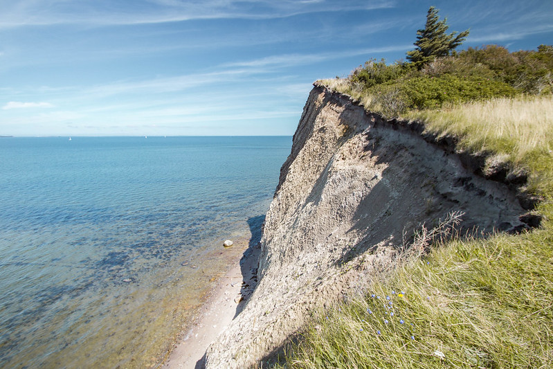
Lille Knudshoved
To reach Lille Knudshoved, we went back to the brewery. Then we continued on the road, leaving the brewery and took the first path on the right down to the beach.
You can walk on the beach or the small grass path right next to the beach. Lille Knudshoved is 15-20 minutes walk away.
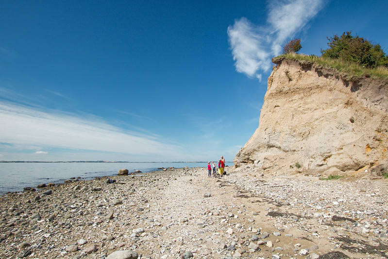

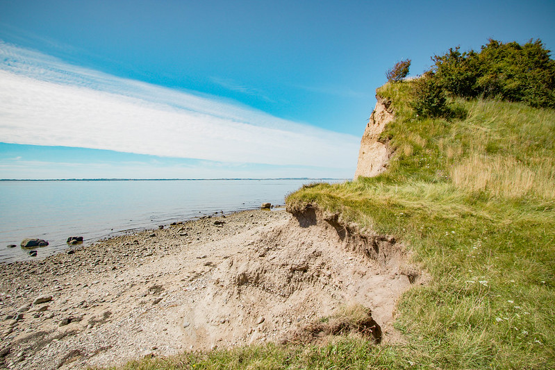
The beach
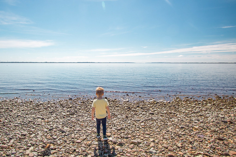
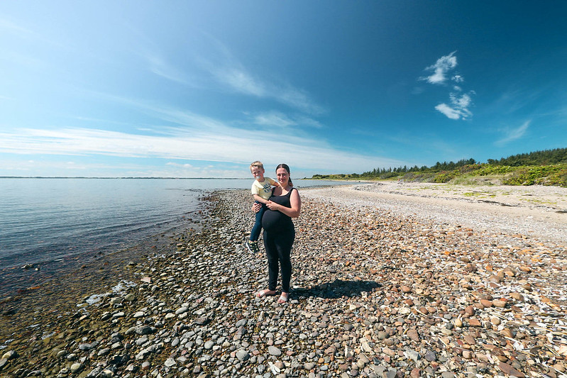
You can follow the beach all the way from the harbour to the cliffs. It’s a beautiful walk, I imagine, but you’d need proper footwear, like sneakers. Not flip flops or light sandals, since the stones and sharp sea shells make the terrain uneven and slightly uncomfortable to walk on.
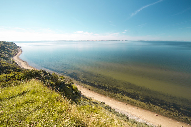
With that said, do go to the beach. The water is beautiful and so clear, and you can see across the fjord to Jutland and Livø, a nearby island.
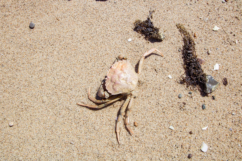
While you’re there, look for fossils, and crabs. We saw lots of crabs the day we visited.

Bispehuen
One of the highlights on Fur Denmark is Bispehuen and the area around it. It’s located on the north side of the island, a short drive from the cliffs.
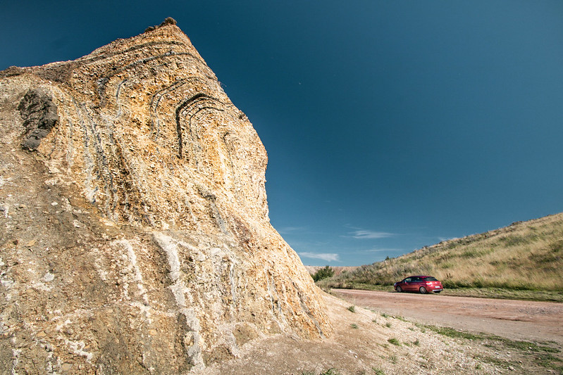
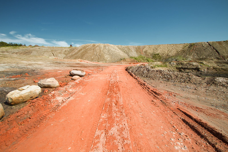
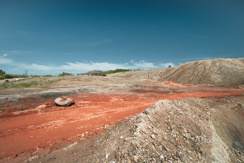
Bispehuen is a manmade pillar of moler. Its shape has inspired the name Bispehuen, which in English translates to “the Bishop’s hat”.

Stendal Høje
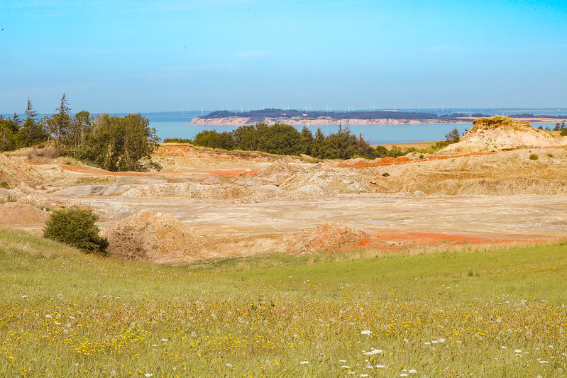
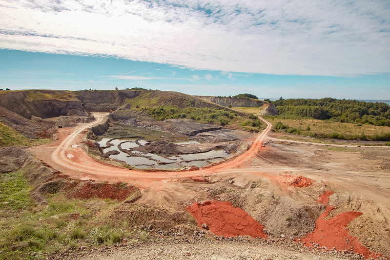
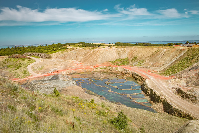
On the hill above Bispehuen you’ll get an amazing panoramic view of the island and the moler quarry. You can spot all kinds of colours, from red to yellow and green to blue.
Stendalgraven
Right next to Stendal Høje is Stendalgraven. There’s a parking lot at the hill above it if you don’t want to drive down there.
Stendalgraven is Fur’s largest raw material quarry and it’s the best place to go fossil hunting. Here, you can see the layers of volcanic ash and moths in the exposed slopes. Fossils aren’t found in the moler itself, but in cement stones like you see below. You’ll need a special hammer to split them open.
You can go here yourself and just start digging, or you can join a fossil hunt tour where there’s digging equipment included and experts onsite to help you identify your finds.


Rødstenen
Not far from Stendalgraven, you’ll find Rødstenen (‘Red Stone’ – not to be confused with its twin ‘The Red Stone’, which is located on the beach). It’s a 14m wide and 5m thick sand stone rock that’s made of meltwater sand, gravel and moler iron.
Langstedhuller
The last place we visited on Fur Denmark was Langstedhuller, which is an amazingly beautiful area.
It’s a system of holes with the sea as its background. The holes are erosion gorges from the Ice Age, and you can walk down there or just admire the view from the top (what we did).
We had brought a picnic and this was the perfect place to enjoy it, while Theo played in the grass. I highly recommend it!


How to get to Fur Denmark
It’s really easy getting to Fur Denmark. There’s only one way and that’s by ferry.
Fur is located in Limfjorden, in north-west Jutland. Simply set your GPS for Branden and you’ll get to the ferry. It runs every 15 minutes and only takes 4 minutes to cross over. The trip is pretty motionless and we didn’t even know we were moving until we reached Fur island.
While we were waiting in line to drive onboard, a man came up to us with a credit card machine. You automatically pay for a round trip, which is 120 DKK. While they didn’t check the ticket on our way back, remember to keep the receipt!

Going to Fur Denmark? Ask me anything in the comments!
More stuff you’ll love:
- Must-see: 25 best places to visit in Denmark
- Summer: Summer in Denmark: 25 amazing activities
- Winter: Winter in Denmark: 15 hygge cold-weather activities
- Beaches: 12 best beaches in Denmark
- Nature: 12 mind-blowing places for nature in Denmark
- Camping: Camping in Denmark for beginners
- Wild camping: The ultimate guide to wild camping in Denmark
- UNESCO sites: Experience the 7 UNESCO sites in Denmark
- Danish food: 20 amazing dishes you must try in Denmark



very nice thanks so much for sharing
You’re welcome!
Stunning shots. Wow! Hopefully, they will put some resort near there or a hotel so tourist can enjoy the place for a few days.
They already have accommodation on Fur island. Look for B&Bs or Fur Færgekro https://furkro.dk/overnatning.aspx (in Danish) 🙂
It looks stunning! Is there a map I can download? I tried the one that was mentioned but it won’t work. And for the hiking trails, are there some indications? Are also routes on the map? That would be very helpful. Thanks!